Geospatial Extensions for ESRI®
Link facility and infrastructure data with the intuitive power of geospatial technology to make informed decisions
Benefits
- Improves organizational collaboration and decision-making by providing geospatial business intelligence for sites, space, infrastructure, and physical assets
- Combines real estate, facility, and infrastructure with geospatial information to provide visual representations that improve analysis for competitive advantage
- Allows both interior and exterior data to be queried simultaneously to visualize an organization’s assets and streamline enterprise workflow processes, enabling business transformation
- Leverages ESRI’s pre-eminent expertise in aggregating mapping and geospatial information quickly and at low cost

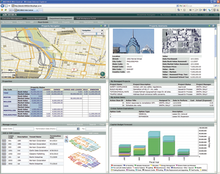
Incorporate a geospatial perspective directly within your ARCHIBUS Web Central dashboards to unlock the power of geospatial visualization for improved analysis, reporting, and decision-making
Many leading organizations recognize Geospatial Information Systems (GIS) as an essential information tool to address extended markets, aging infrastructure, shifting demographics, and compressed cycle times. The knowledge gained from GIS allows organizations to make better decisions, saving time and resources. You can now use powerful geospatial capabilities to illuminate your existing real estate, facility and infrastructure information through the ARCHIBUS Geospatial Extensions for ESRI. This integration will provide you an even more powerful multi-layered perspective of critical organizational initiatives.
”
